Algal blooms are a severe ecological disaster that threatens aquatic systems around the world. They pose a threat to public health and biodiversity. To protect our interests, we need continuous monitoring and early warning systems. Most traditional monitoring methods, such as field measurements and sampling followed by laboratory analysis, are logistically tricky, time-consuming, and labor-intensive.
Remote sensing, however, has been recognized as a valuable tool in studying algal blooms due to its large-scale applicability, real-time data collection, and long-term monitoring capabilities. Despite its limitations in spatial, spectral, and temporal coverages, remote sensing is widely accepted by researchers and environmental managers as a valuable and cost-effective alternative.
The integration of multi-sensor data types, innovations in the field of AI, and advancements in data quality and sensor capabilities have improved the accuracy of remote sensing for algal bloom monitoring. By integrating these advanced monitoring systems with early-response technologies that are both environmentally friendly and efficient in preventing algal blooms, we can protect human health and the environment at the same time.
What are algal blooms?
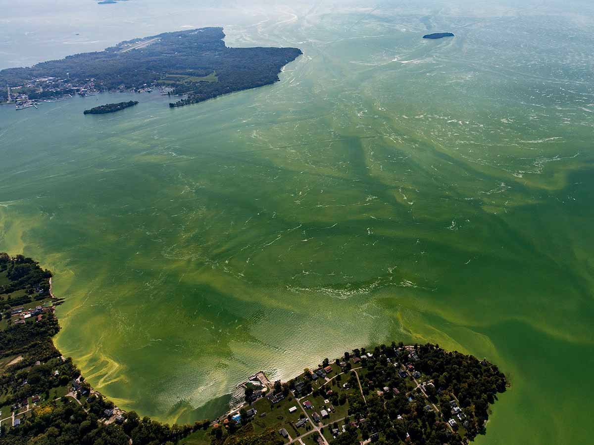
Phytoplankton, or suspended algae, is a critical component of freshwater food webs: they serve as the main source of food and energy for the entire ecosystem. However, an increased supply of nutrients or pollutants can lead to an explosive overgrowth of algae. This phenomenon is known as algal blooms. Due to eutrophication, these blooms result in surface color changes, foul smell/taste, death of aquatic plants and animals, and changes in the food web that can become permanent and destroy entire ecosystems.
Cyanobacteria, a type of blue-green algae, are among the most notorious culprits. Not only can they cause algal blooms, but they are frequently able to produce toxins that endanger humans, domestic animals, fish, and wildlife. On top of this, they are capable of surviving under extreme environmental conditions.
The impacts of harmful algal blooms on freshwater ecosystems have been intensifying in recent decades, due to a variety of compounding factors, including but not limited to intensified agriculture which results in fertilizer runoff, climate change, thermal extremes, low dissolved oxygen, and low pH. Since algal blooms pose a threat to public health and biodiversity, it’s crucial to be able to predict, detect, and monitor them effectively.
Remote sensing
The monitoring of algal blooms is vital for ensuring the safety of aquatic life, drinking water quality, shellfish, and public health. To achieve this goal, it is necessary to detect and monitor the presence of algal blooms, including their species and potential toxins. Additionally, monitoring nutrient concentrations, such as those from agricultural and urban runoff, is important in studying algal blooms and possibly predicting their occurrence.
Remote sensing technology offers a cost-effective solution for detecting and monitoring algal blooms in freshwater lakes. There are several remote sensing platforms available, including ground-based, spaceborne, airborne, and unmanned aerial vehicle (UAV) systems. New chemical and biological sensors, both in-situ and remote, have also been developed for early warning and routine monitoring of freshwater resources.
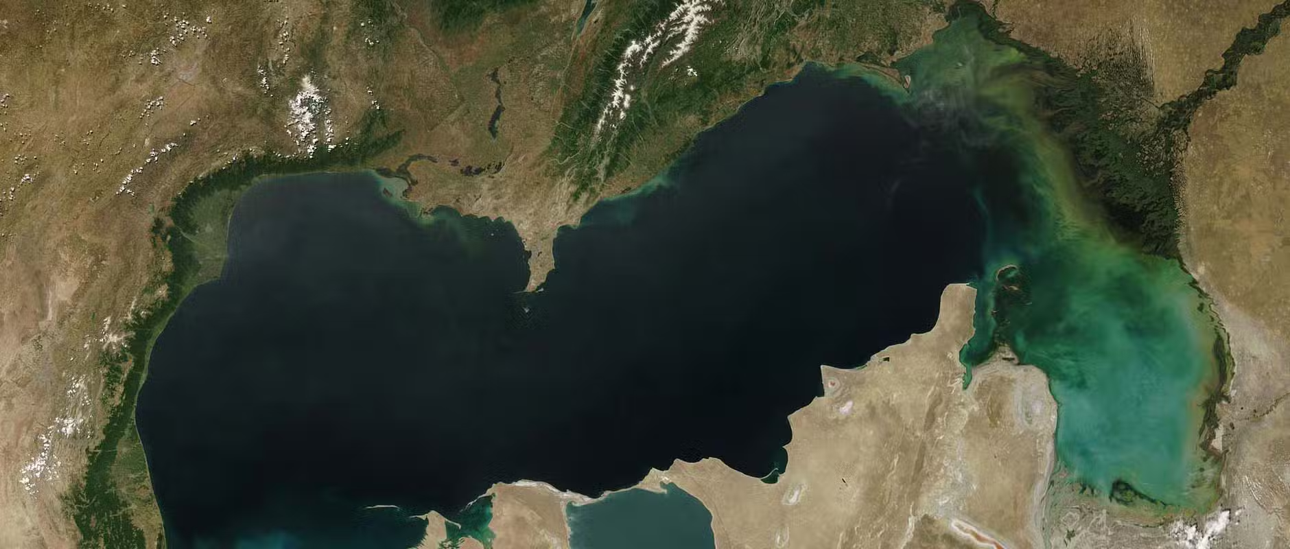
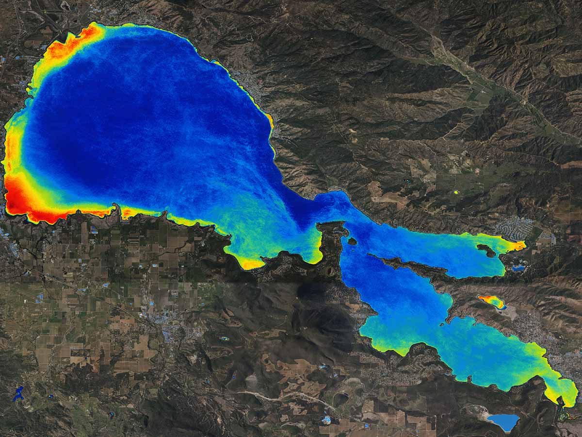
Satellite remote sensing has proven to be one of the effective means of observing algal blooms with frequent and widespread coverage. Algal concentrations can be estimated using several proxies, such as with the concentration of chlorophyll-a which can be determined by analyzing the water’s color. Other factors which indicate potential algal blooms, such as the presence of Phycocyanin, high Turbidity and low Dissolved Oxygen, can also be studied remotely. Most studies use multispectral sensors on satellites to detect color changes, while hyperspectral data can also be used for species-specific analysis. Some of the most commonly used sensing methods are:
- Optical remote sensing: This method involves the use of satellite and aerial imagery in the visible and near-infrared spectrum to identify and monitor algal blooms. This is based on the principle that the presence of algal pigments, such as chlorophyll-a, affects the spectral properties of water, which can be detected and analyzed using remote sensing techniques.
- Radar remote sensing: This method uses microwave frequencies to detect the presence and distribution of algal blooms in water bodies. The backscatter signal generated by algal blooms in the radar frequency band can be used to estimate their biomass and spatial distribution.
- LiDAR remote sensing: This method involves the use of laser light to measure the water column and detect the presence and distribution of algal blooms in water bodies. LiDAR can provide high-resolution vertical profiles of the water column, which can be useful in detecting and monitoring algal blooms in shallow waters.
- Multi-spectral Remote Sensing – Multi-spectral remote sensing uses various spectral bands to measure the reflectance of the water surface, which can be used to estimate the concentration of algal pigments in the water.
- Hyper-spectral Remote Sensing – Hyper-spectral remote sensing collects high-resolution spectral information, which can be used to identify specific species of algae and quantify the concentration of algal pigments in the water.
How is data used?
Sensors fulfill their purpose by accurately detecting the specific signals they are designed to monitor. This can generate mind-boggling quantities of data. But what then? The data collected from these sensors serve a variety of purposes for environmental managers, based on their specific goals and available resources. Some of the most common ways of analyzing and using data include:
- Global Mapping: This is a remote sensing technique that utilizes satellite data to create maps of HAB distribution in large water bodies. It provides information on the spatial extent and intensity of HABs.
- Genetic Algorithms: These are AI techniques that predict the occurrence and distribution of HABs. They are based on the principles of evolution and simulate complex interactions affecting the spread of algal blooms.
- Empirical Models: These are mathematical models based on data from field studies or experiments. They predict the occurrence and distribution of HABs and assess the impact of environmental conditions on algal blooms.
- Artificial Neural Networks: These are models inspired by the structure of the human brain and can learn from historical data to make predictions based on new data.
- Convolutional Neural Networks: These are machine learning techniques used to detect and classify objects in images, including HABs. They can be trained on collected data, such as satellite imagery, to identify the presence and distribution of HABs.
- Eco-Hydrodynamic Models: These are mathematical models that simulate the interactions between water, air, and biotic components in aquatic systems. They can predict the occurrence and distribution of HABs and assess the impact of environmental conditions on algal blooms.
Our contribution
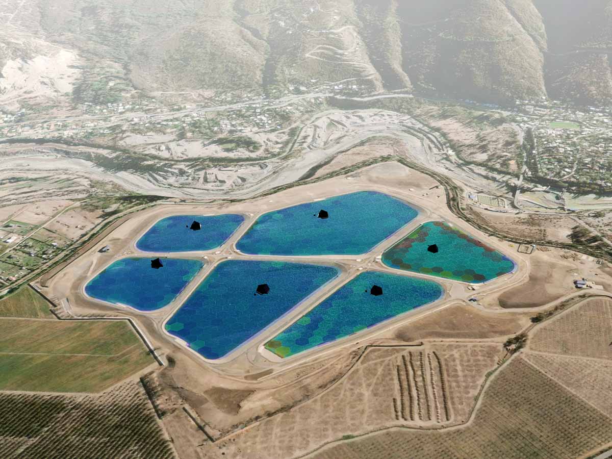
At LG Sonic, we harness the power of cutting-edge remote sensing systems like Sentinel 2, Landsat 5, MODIS, and others to create a comprehensive and intricate representation of Earth’s surface. Our wealth of water quality data, accumulated over three decades, along with our strategic partnership with Google, and our MPC-Buoy sensors that deliver real-time, in-situ data, provide an unparalleled level of detail and context.
Our integrative sensing approach empowers us to quickly respond to potential algal blooms, and effectively mitigate their growth using our ultrasonic technology. This innovative solution not only prevents the proliferation of cyanobacteria, but also maintains the ecological balance of freshwater systems while being cost-effective and highly efficient.
Conclusion
In conclusion, algal blooms pose a significant threat to aquatic systems and their monitoring is crucial for the protection of public health and biodiversity conservation. The traditional methods of monitoring and modeling algal blooms, such as field measurements and laboratory analysis of samples, can be logistically difficult and time-consuming. Remote sensing, on the other hand, offers a more efficient and cost-effective solution for monitoring algal blooms on a large scale in real-time. Despite its limitations in terms of spatial, spectral, and temporal coverages, remote sensing is widely accepted as a valuable tool in the monitoring of algal blooms. The integration of multi-sensor data and the improvement of data quality and sensor capabilities are expected to make remote sensing an even more powerful tool in the future. With the aid of multi-frequency, multi-polarization data and the use of more advanced LiDAR sensors, the monitoring and modeling of algal blooms will become increasingly sophisticated and accurate.