
In short
- Real-time data is essential in algae and water treatment;
- Combining different types of data is the most effective method;
- The MPC-Buoy can collect in-situ, vertical profiling, satellite, and meteorological data.
The role of data in water treatment
In the long run, treating blooms after contaminating our surface waters isn’t an effective solution. Instead, a better understanding of what drives harmful algal blooms (HABs) is needed. And the ability to prevent them—building a forecasting model based on accurate data.
First, we need to identify factors that create the ideal conditions for algae to grow. These aquatic organisms depend on the relationship between three variables: nutrient load, sunlight, and temperature.
The first step in eliminating algae is collecting data about the water parameters present in the water body and the climate surrounding it.
The next step is the ability to forecast HABs. For this, data collected over a certain period is required, as it offers insights into the frequency and severity of the blooms.
That is, which period of the year they are most likely to occur and what quantity. Knowing when algae will become a problem enables us to take practical steps to prevent it.
Combined data collection method
Collecting in-situ water quality data, as well as meteorological, and satellite remote sensing data allows water managers to tackle HABs more effectively.
By combining these types of information, they can build empirical data-driven models enabling them to recognize patterns and trends, track changes in water bodies, and warn water utilities if possible contamination occurs so they can protect their water supply in time.
The public can also be notified to avoid contact with toxic waters.
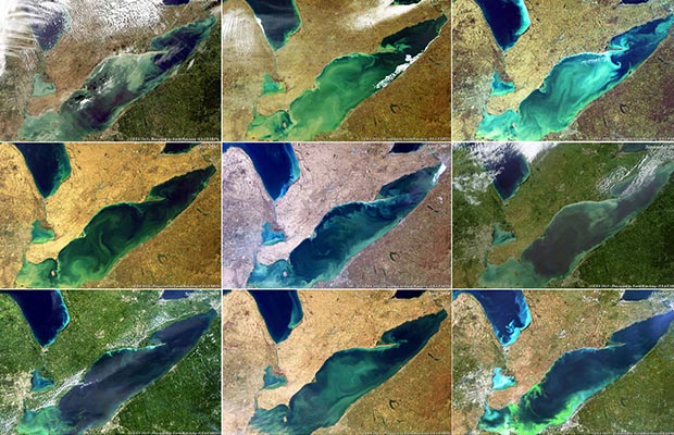
This is what’s being planned for Lake Erie (situated between Canada and the US). The lake has hit the headlines for some time now, as it has been struggling with severe algae blooms for years.
Researchers at the University of Windsor have received a grant of more than $1 million to invest in the understanding and prediction of HABs in Southwestern Ontario. To gather accurate data, seven real-time monitoring buoys and another 50 small aquatic sensors are set to be deployed in the lake for the rest of the year.
“Real-time sensors are considered a game-changer because they could allow scientists to accurately identify what is causing the blooms and use that information to predict when and where they are going to happen.”
There’s a great potential to reduce costs by mitigating algae problems in time. Research showed that freshwater eutrophication and algal blooms cost the US approximately $2 billion per year.
Data-driven treatment and forecasting
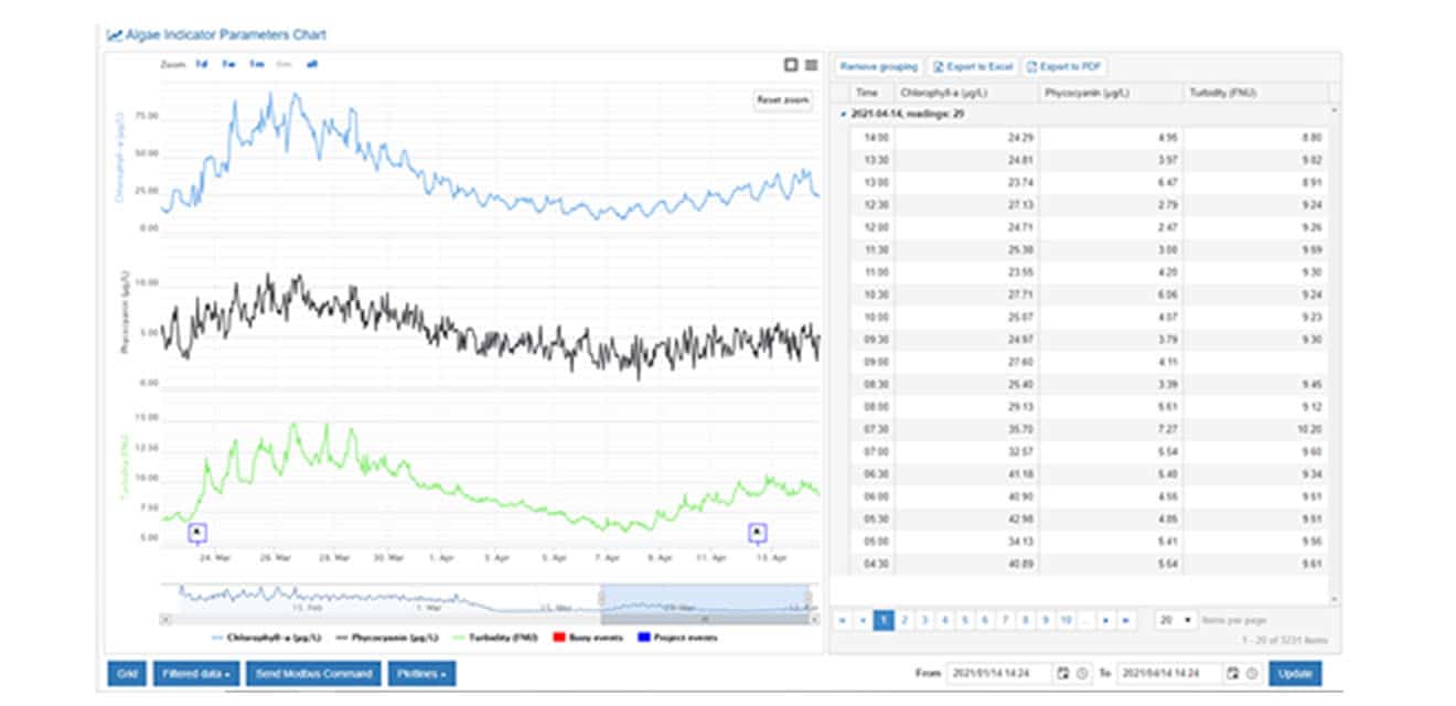
The MPC-Buoy collects key water quality parameters every 10 minutes. A weather station can be added on top of the buoy to gather extra information about sunshine hours, wind speed & direction, air temperature, and absolute humidity.
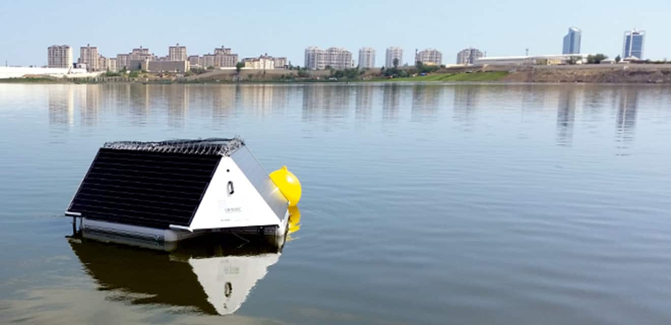
The buoy is continuously analyzing water, algae, and weather parameters. It’s collecting and storing this data into its system. This information can be accessed anytime through a cloud-based software – MPC-View.
Ultimately, tracking water parameter changes in real-time enables us to be more proactive about surface water management. The MPC-Buoy algorithm uses the information it collects to emit a specific ultrasonic frequency that stops algae from growing. Besides, the system predicts blooms 3-10 days before they occur. If there are changes in water, like rising pH levels for example, the buoy automatically adjusts its ultrasonic program to comply with the new water conditions. Then, it emits a new frequency that’s more effective in controlling the algae.
You might ask, what happens if the buoy doesn’t change the ultrasound frequency based on real-time data? Naturally, that is where effective algae control stops. As highly adaptive organisms, algae can easily adjust to treatment methods. To avoid this, the buoy notices specific behavior changes in algae and chooses the most optimal frequency.
In case of inaccessible areas of the surface water, it’s possible to integrate remote sensing into the system to gather satellite images of the entire water body. Over time, this combined data collection method allows us to track changes in water bodies more accurately and better anticipate and address algal blooms.